01Automated Reconnaissance
Find what moves before deploying field crews.
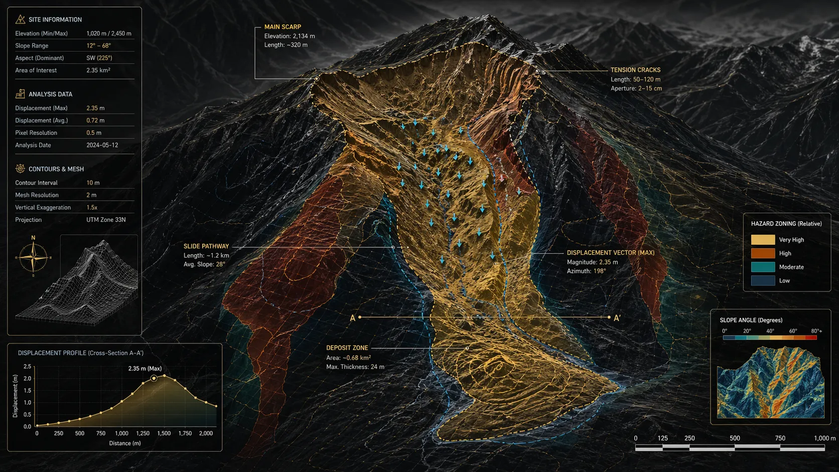
Regional-scale hazard detection using automated optical and radar derivatives to flag slope instability across massive geographical footprints.
TerraFacet is a Calgary-based geospatial technology company developing advanced tools for terrain intelligence and Earth-surface change monitoring.
Our work combines Earth observation, remote sensing, geoscience, and computational analytics to help organizations understand how terrain is moving across large and complex landscapes. We focus on practical intelligence for sectors such as energy, mining, infrastructure, environmental monitoring, and natural hazard assessment.
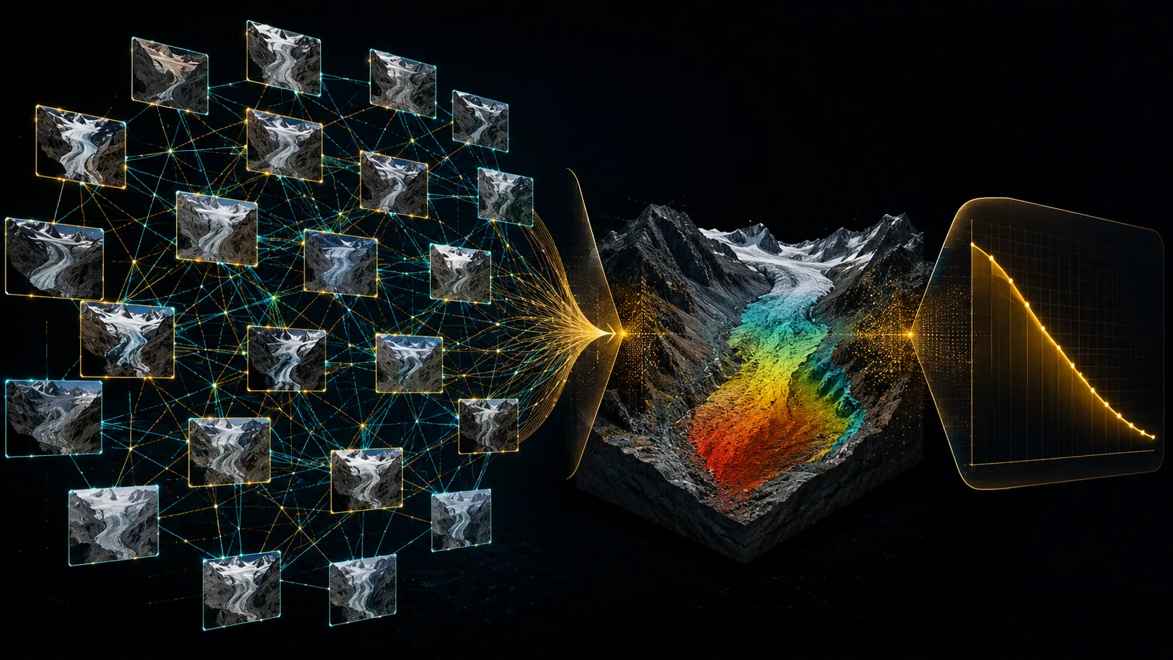
Our first platform, TerraKineo, converts multi-temporal satellite imagery into displacement, velocity, and change-detection products. It is designed as a wide-area screening layer that helps identify where terrain motion is occurring and where detailed inspection, instrumentation, or engineering review may be needed.
TerraFacet translates research-grade geospatial workflows into scalable, decision-ready intelligence for operational landscapes.
Continuously monitoring the physical evolution of critical infrastructure and terrestrial landscapes through high-frequency optical and synthetic aperture radar constellations.
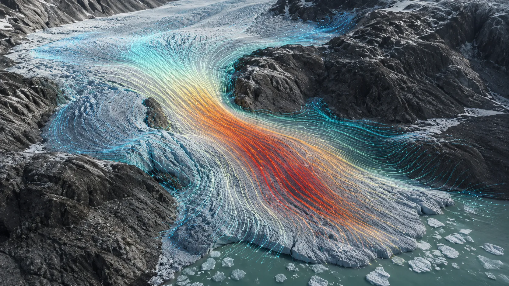
Proprietary pixel-tracking algorithms and advanced photogrammetry isolate true kinematic movement, revealing surface changes while stable terrain remains visually quiet.
Regional-scale hazard detection using automated optical and radar derivatives to flag slope instability across massive geographical footprints.
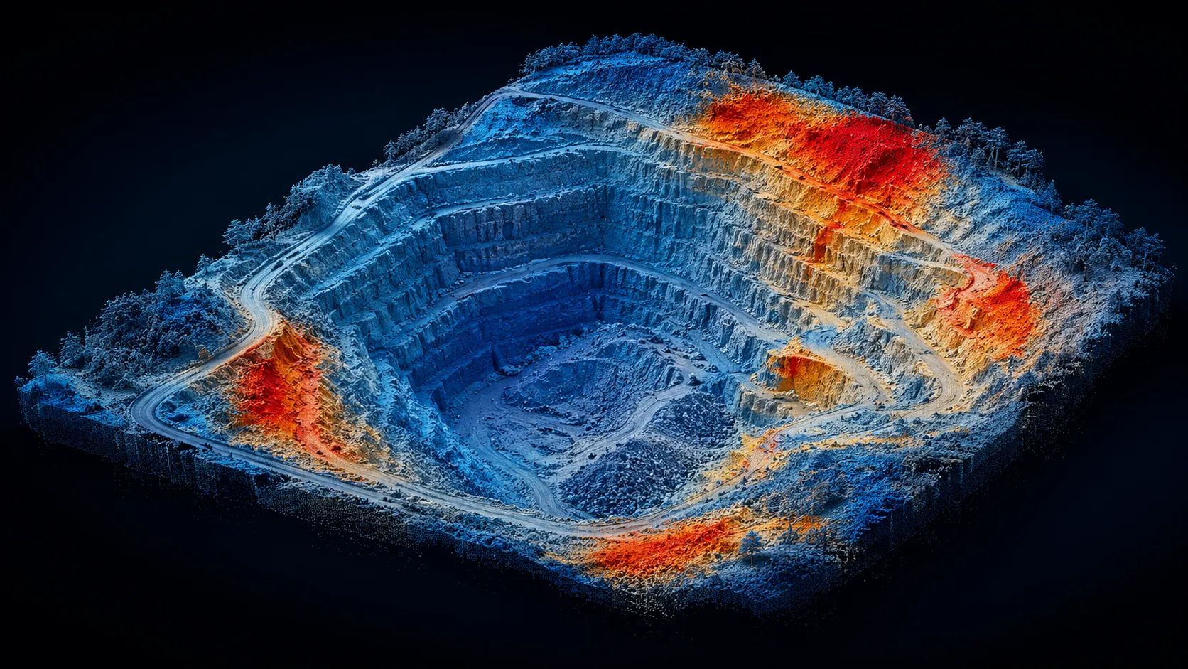
Precision DEM-of-difference, sediment budgets, and volume calculations derived from paired optical and drone assets.
Computational cross-correlation of optical imagery to extract clear horizontal terrain motion across large basins.
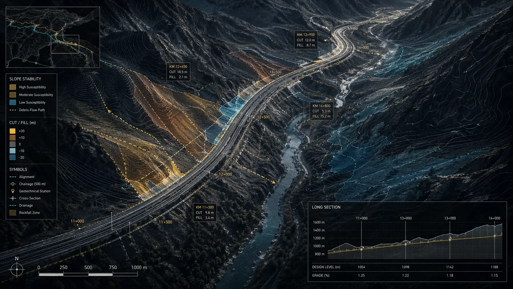
Algorithm-driven least-cost routing mapped against terrain, slope stability, and structural constraints.
Scroll to explore →
Seamless integration of multi-constellation satellite archives (optical & radar) and client-provided UAV datasets.
Automated sub-pixel alignment and structural matching of temporal image stacks for reliable baseline establishment.
Proprietary parallel processing of pixel-tracking and photogrammetric pipelines across massive spatial extents.
Filtering algorithms isolate true kinematic motion from atmospheric noise, illumination shadows, and seasonal variations.
Delivery of clear, scalable, and API-ready geohazard intelligence for integration into enterprise workflows.